Editorial Picks
The Quietest Walks in Gangnam, Ranked by Pace
Ten flat, short-distance routes in Gangnam, organised by pace — slow and moderate — for the unhurried itinerary.
Gangnam has the reputation of a vertical, glass-lit district — the storefronts loud, the avenues wide, the lifts always full. What recommends it, however, is not the spectacle but the small flat circuits the locals keep to themselves. There are quiet pockets here — Dosan Park before 9 a.m., the Seonjeongneung tomb grounds at any hour, the Hannam-bound side of Han River — and they reward the unhurried visitor in a way Causeway Bay no longer can. This is a list of ten such walks, organised not by ranking but by pace. Read it as a curated map, not a leaderboard. The clinics on this end of the city expect their patients to walk gently for the first week after a procedure; what follows is, in part, a regimen of doing exactly that.
Methodology — what 'quiet' meant, and what 'pace' is doing here
Quiet, in this list, is a measurable rather than poetic quality. Each route was walked twice — once on a Tuesday between 8 and 11 a.m., and once on a Saturday between 4 and 6 p.m. — and assessed against four criteria: ambient sound (subjectively rated against a Causeway Bay weekday baseline), pavement evenness (a recovery concern, not a luxury one), elevation change (the brief favoured flat or near-flat surfaces; nothing exceeding fifteen metres of gain end-to-end), and the density of pedestrian crossings demanding attention. The pace categorisation — slow or moderate — is therefore not a verdict but a logistical hint. A slow route is one a patient can walk in soft trainers within four days of a procedure; a moderate route assumes a fortnight has passed and the pavement no longer counts as therapy. Distance ranges from 800 metres to 2.4 kilometres. None of the routes require a taxi at either end; all begin and end within four hundred metres of a Seoul Metro station. Where the pavement turned to gravel — a small concern for those still on the cane — the route was either trimmed or reclassified. The intention, throughout, was undramatic: ten reliable, low-stimulation circuits a discreet visitor could repeat across a recovery week without ever feeling she had repeated herself. 呢個list係以慢為先, as a friend in Lee Garden Three put it; the priority was, first and last, slowness. A few routes that initially shortlisted — the Apgujeong-rodeo back-street grid, the small park behind Cheongdam Plaza, the Galleria service-lane loop — were dropped on the second walk because the acoustic register, while low at the entry point, climbed sharply at one or another node within the loop. The list that remained, ten routes, is the list that survived both passes; nothing in it carries the asterisk a single observation would have demanded. Each entry below carries six standardised metrics — distance, surface, elevation, pace, best window, and nearest station — so the visitor can scan rather than read where scanning suffices.
— Dosan Park interior loop (slow)
Dosan Park's interior loop is a 900-metre flat circuit through a wooded square block bounded by Dosan-daero and the back streets of Sinsa-dong, and it is — quietly, consistently — the calmest walk the district allows. The path is paved in fine compacted gravel for most of its length, with a brief rubberised stretch behind the memorial hall; both surfaces forgive the kind of soft trainer one wears in the first week after a procedure. The lift from Apgujeongrodeo Station, Exit 5, is one block south, and the canopy keeps direct sun off the path through most of the morning. One arrives, takes a slow lap, and is offered — by the park itself, somehow — the same hush a hotel lobby offers when the lift doors close. The benches are teak, the lighting at dusk is soft amber, and the pavement is even enough that a patient can read a phone without breaking stride. There is a Tous Les Jours on the corner of the south gate; there is also, opposite, a small unbranded coffee bar whose pour-over is undramatic in the best sense. Most mornings the loop holds fewer than a dozen walkers. The acoustic register sits well below a Tatler Asia café in Lan Kwai Fong — closer, in fact, to a private library reading room. Recommended for days one through four post-procedure, repeated as often as one likes; the loop is short enough that two consecutive laps are still gentler than a single trip to the Galleria. The memorial hall itself, set off-axis in the southwest quadrant, is worth a brief seated pause inside its open courtyard — the stone is cool, the visitor population sparse, and the bench placement deliberate. A first-time visitor is well served by entering from the south gate, walking the loop counter-clockwise, and exiting to the north of the memorial; the orientation places the canopy on the sun-facing side throughout, which matters more than one might expect on a clear May morning.
- Distance: 900 m (single loop), 1.8 km (double)
- Surface: compacted gravel + rubberised section
- Elevation gain: under 4 m
- Pace category: slow
- Best window: 7:30–10:00 a.m., or after 7 p.m.
- Nearest station: Apgujeongrodeo (Line 3, Bundang)
— Seonjeongneung Royal Tomb perimeter (slow)
The Seonjeongneung perimeter — the broad, fenced grass apron that wraps the two royal tombs near Seolleung Station — is technically a UNESCO-flagged heritage ground, and that institutional weight has, over the years, kept it remarkably empty. The path inside the gate is broad, level, and tree-shaded; the surface alternates between fine grit and polished stone, neither of which catches the heel of a soft trainer. Admission is a thousand won, paid at a small booth that accepts both cash and card, and the gate closes by 6 p.m. in winter and 9 p.m. in summer. The full perimeter walk — the larger of the two loops the grounds offer — runs to roughly 1.4 kilometres, with the smaller loop closer to 800 metres; both are flat to within a few metres of grade. What recommends Seonjeongneung is not the historical monumentality but the acoustic vacuum it sustains a hundred metres in: the Gangnam-daero traffic, even at rush hour, falls away to nothing past the second copse of pine. One arrives, removes a layer, walks a slow lap, and exits feeling as though one has been somewhere other than central Seoul. The benches are concrete, evenly spaced; the only food on the grounds is a vending machine near the western gate. Patients in the second week of recovery report, anecdotally, that this is the route they returned to most. Sundays are slightly busier, but never crowded by Apgujeong standards. 呢個地方好靜, the lady at the booth told me on a second visit, and she meant it. The interpretive signage along the perimeter is bilingual Korean and English; visitors who prefer not to be addressed by docents — and most discreet travellers do — should know the staff observe a respectful distance unless approached. The grounds permit photography but not flash inside the immediate tomb mound zone, which is in any case set behind a low fence and need not be approached at all for the perimeter walk to register.
- Distance: 800 m (small loop) or 1.4 km (perimeter)
- Surface: compacted grit + polished stone slabs
- Elevation gain: under 5 m
- Pace category: slow
- Best window: weekday mornings, any season
- Nearest station: Seolleung (Line 2, Bundang)
— Yangjae Stream upper bank to Maeheon Bridge (slow)
Yangjae Stream — Yangjaecheon, on the maps — runs as a low concrete-banked watercourse between Gangnam-gu and Seocho-gu, and the upper-bank section between Yangjae Citizens' Forest and Maeheon Bridge is a 1.1-kilometre stretch that reads, on first impression, as an urban afterthought and on second impression as something more. The path is fully paved in dark asphalt, level to within a centimetre, and segregated from cyclists by a painted line and, in most places, a low planting bed. The lift from Yangjae Citizens' Forest Station, Exit 5, drops one practically onto the upper bank. There is no shade in the strict sense, but the row of cherry trees lining the south side does soften the midday glare from late spring through early autumn. The acoustic register is genuinely low — the watercourse muffles the Gangnam-daero, two hundred metres east, in a way that surprises on first encounter. One walks, perhaps, for twelve minutes to Maeheon Bridge, crosses, and returns on the opposite bank. There are no cafés directly on the path; the closest is a Tous Les Jours one block north of the Maeheon end, where the pour-over is unremarkable but the bench outside is well-placed. The route is recommended for days four through ten post-procedure, when one is ready for marginally more distance but not yet for elevation. Patients in their second week often pair this with a return loop through the forest itself, bringing total distance to 2.2 kilometres; the elevation across that combined route remains under ten metres.
- Distance: 1.1 km (one-way), 2.2 km (return)
- Surface: dark asphalt, painted bicycle separation
- Elevation gain: under 3 m
- Pace category: slow
- Best window: late afternoon, before sunset
- Nearest station: Yangjae Citizens' Forest (Sinbundang)
— Bongeunsa Temple outer wall (slow)
Bongeunsa, the Buddhist temple complex opposite COEX, has — by virtue of being a working temple — kept the broad walking apron along its north and east outer walls quiet for as long as one cares to remember. The route along the outer wall, taken counter-clockwise from the main gate, runs roughly one kilometre and remains flat for the first seven hundred metres; only the final stretch climbs gently toward the bell pavilion, and that section can be skipped by reversing the loop. The path is paved in even granite slab, with the kind of slight roughness that helps rather than hinders a soft trainer. Admission to the complex is free; one is asked, gently, to remove headwear inside the main hall, but the outer wall walk is unrestricted. What recommends Bongeunsa is the sound of the temple — the morning chant from the prayer hall carries over the wall, and at certain hours the bronze bell adds its single low register — without any of the spectacle one might fear. The Causeway Bay equivalent does not really exist; one would have to walk the perimeter of Po Lin on Lantau, and even then the sense of the city pressing on the wall would be missing. The loop holds a small population of regulars, mostly residents of the surrounding apartment blocks, and a smaller population of monks; the latter outnumber tourists most weekday mornings before nine. The route is suitable from day three or four onward. Visitors should know that Bongeunsa hosts an English-language Templestay programme one Thursday a month, and the outer wall on those evenings holds a slightly larger and slightly more contemplative pedestrian population — quiet still, but not solitary. Otherwise, the loop's regulars keep their pace measured and their conversations low, and the broader complex is best appreciated as architectural backdrop rather than itinerary; the wall walk delivers most of what the temple is, without asking the visitor to cross any threshold she would prefer to leave undisturbed.
- Distance: 1.0 km (full outer wall)
- Surface: even granite slab
- Elevation gain: under 8 m (skippable final stretch)
- Pace category: slow
- Best window: 7–9 a.m. weekday
- Nearest station: Bongeunsa (Line 9)
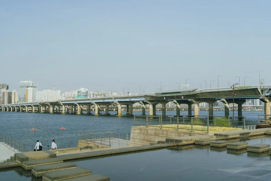
— Han River Banpo north promenade (slow)
The Han River north promenade, taken from Banpo Bridge eastward toward Jamwon, is a 1.4-kilometre flat stretch on the south-facing side of the river, fully paved in red rubberised matting where pedestrians are kept clear of the cycle path by a robust planting bed. The lift down from Express Bus Terminal Station, Exit 8-1, is a brief tunnel; one emerges practically on the promenade. The defining quality of the route is the openness of the sky overhead — the river is wide here, the south bank is set well back, and the visual register stays low for the entire walk. There is shade in patches under the bridge structures, and the rubber surface forgives a soft trainer in a way the granite slabs of the inner streets do not. The acoustic register is moderate by Gangnam standards but low by riverside-promenade standards globally; the walking population thins considerably between 10 a.m. and 4 p.m., when joggers and cyclists migrate elsewhere. Bench placement is generous — every hundred metres or so — and the kiosks selling convenience-store coffee are clean enough that a recovering patient can sit a moment without negotiating a queue. The Banpo Rainbow Fountain runs in the evening; the walk is recommended either before its show begins or well after, since the crowd density rises sharply during. The route is suitable from day four post-procedure for the slow half of the route, and from day seven onward for the full distance. The wind off the river is the variable that defines the comfort of this walk more than any other — on a clear May afternoon the breeze is cool and welcome, on an August humid day it is the only thing redeeming the route, and on a January morning it can render the promenade frankly inhospitable. A windbreak layer is worth carrying year-round. The view across the river to Yongsan and the lit window grid of the apartment towers is, on a clear evening, one of the most quietly composed urban panoramas the peninsula offers; one need not photograph it for it to register.
- Distance: 1.4 km (one-way), 2.8 km (return)
- Surface: red rubberised matting, separated from cyclists
- Elevation gain: under 2 m
- Pace category: slow
- Best window: 10 a.m.–4 p.m. weekdays
- Nearest station: Express Bus Terminal (Lines 3, 7, 9)
— Garosu-gil to Sinsa Wave Park back streets (moderate)
The back streets running parallel to Garosu-gil — between Sinsa-dong and the small park locals call Sinsa Wave — are the first route on this list to register as moderate rather than slow, and the categorisation is earned by surface variation rather than distance or elevation. The 1.6-kilometre loop runs north-east through a grid of low-rise residential blocks; the pavement is even for most of its length but breaks, briefly, at three crossings where granite slab meets asphalt with a small lip. None of these is a serious obstacle a fortnight after a procedure, but a patient still on a cane should know they are there. What recommends the route is the texture of the neighbourhood — small ateliers, quiet flower shops, a Causeway-Bay-Jardine's-Crescent kind of density without the volume. The Tous Les Jours on the south end of the loop is reliable; the unbranded coffee bar two doors down is, for what it is worth, better. Garosu-gil itself — the main avenue — is loud and crowded and is best avoided in recovery; the parallel streets are the point. The route holds a steady but never dense pedestrian population through the day, with a small lull between 2 and 4 p.m. The acoustic register is moderate, well below Apgujeong-rodeo proper. Recommended from day ten onward; not recommended for the first week. A note on orientation: the parallel street one block east of Garosu-gil is the quieter of the two options, and the one this route follows for the longer northern leg; the parallel street to the west has heavier delivery-vehicle traffic in the morning and is best avoided before noon. The southern leg passes a small set-back chapel garden — discreet, unticketed, and entirely walkable — that adds perhaps two hundred metres of canopy if one chooses to detour through it. The detour does not change the elevation profile in any meaningful way, and the chapel itself is closed to visitors who do not have business inside, which is, in this context, a feature rather than a limitation.
- Distance: 1.6 km (loop)
- Surface: even pavement with three minor transitions
- Elevation gain: under 6 m
- Pace category: moderate
- Best window: 11 a.m.–2 p.m. weekday
- Nearest station: Sinsa (Line 3)
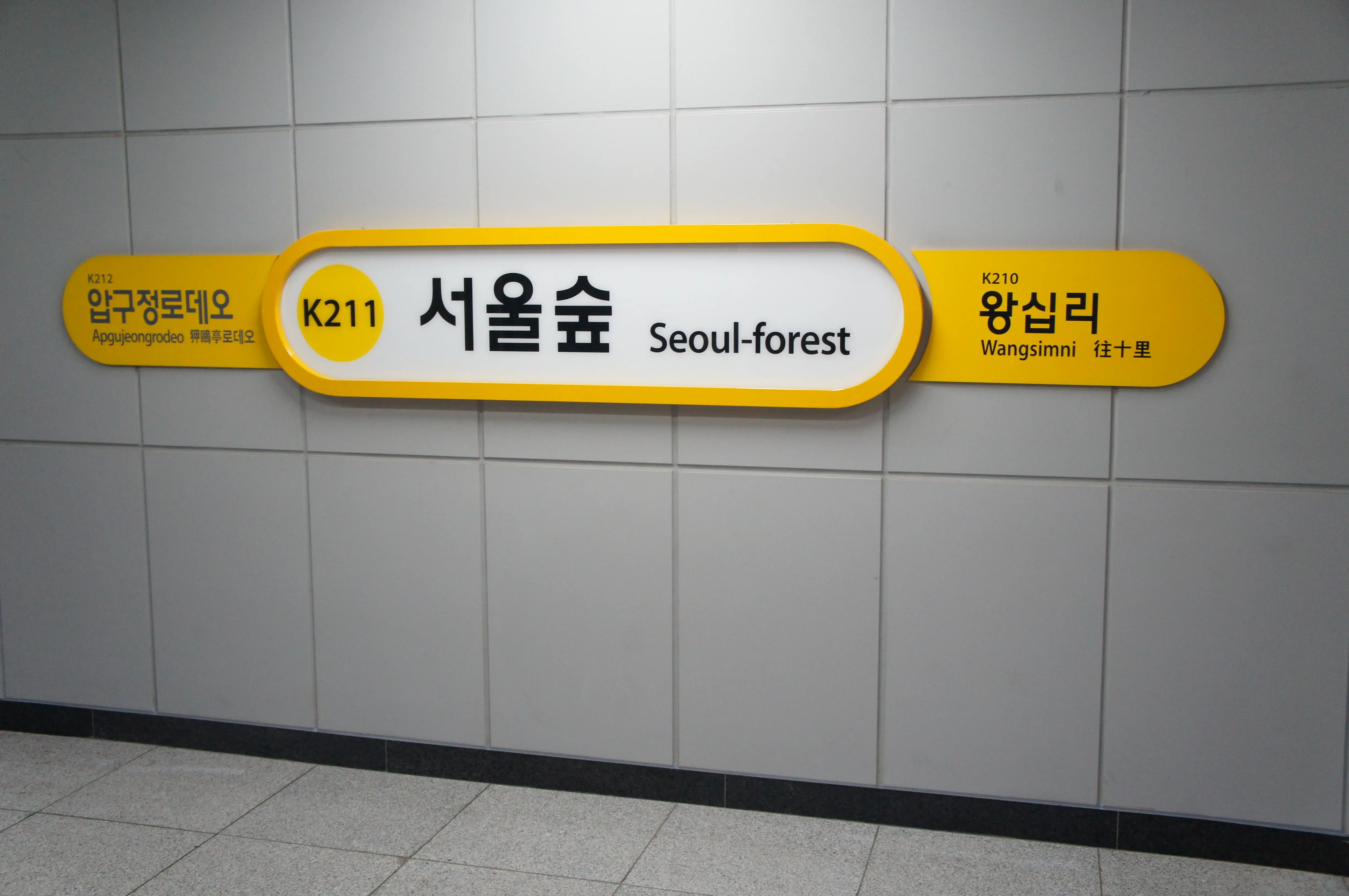
— Seoul Forest western edge (moderate)
Seoul Forest sits across the river from Gangnam proper — Seongsu, technically — but the western edge is reachable by Bundang Line in eight minutes from Apgujeong, and the route there qualifies for this list because it earns its place. The 2.0-kilometre walk runs from the Seoul Forest Station gate through the eastern entrance to the deer enclosure perimeter and back. The path is paved in fine asphalt and compacted earth, both even, with one short wooden boardwalk section near the north pond that flexes mildly underfoot — a moderate-pace concern, not a slow-pace one. The deer enclosure is, paradoxically, the quietest stretch of the route on weekday mornings; weekends draw a small family population, but never a crowd. What recommends the western edge over the eastern is the canopy — the trees are denser, the light filters better, and the acoustic register stays low even when the lawn closer to the river is busy. The route is recommended from day ten through day twenty post-procedure, when distance becomes a useful conditioning tool but elevation should still be avoided. There are two cafés inside the park; the better of the two is the smaller, near the eastern entrance, where the pour-over is, again, undramatic in the right way. One can pair this walk with a brief seated rest before returning, which extends the comfortable distance window without taxing the recovery itself.
- Distance: 2.0 km (out-and-back)
- Surface: fine asphalt + brief wooden boardwalk
- Elevation gain: under 7 m
- Pace category: moderate
- Best window: 9–11 a.m. weekday
- Nearest station: Seoul Forest (Bundang)
— Olympic Park rose garden circuit (moderate)
Olympic Park is, strictly, in Songpa-gu rather than Gangnam-gu, but the Mongchontoseong Station entrance is twelve minutes by Line 8 from the heart of Apgujeong, and the rose garden circuit on the park's western flank is one of the few moderate-distance flat routes the broader district offers without sacrificing quietness. The 2.2-kilometre loop runs anti-clockwise through the rose garden proper, past the small earthen-fortress mound (which one walks alongside, not over), and back through the Peace Gate plaza. The surface is dark asphalt for most of the route with a short cobbled section at the Peace Gate end; the cobbles are even, but a patient still favouring soft trainers should know the transition is there. Elevation across the loop stays under fifteen metres, the maximum threshold for inclusion in this list, and most of that gain is gradual rather than stepped. What recommends the rose garden is the acoustic vacuum the park sustains: the surrounding apartment blocks are set well back, and the only persistent sound is the crunch of one's own footfall. The route is suitable from day twelve onward, with the full 2.2 kilometres reasonable from day fifteen. There are two small cafés near the Peace Gate; both are reliable, neither is exceptional. The roses peak in late May and again in early October; the rest of the year, the route is no less quiet, only less photographic.
- Distance: 2.2 km (loop)
- Surface: dark asphalt + brief cobbled section
- Elevation gain: under 15 m
- Pace category: moderate
- Best window: 8–10 a.m. or 4–6 p.m.
- Nearest station: Mongchontoseong (Line 8)
— Cheongdam-dong residential quarter loop (moderate)
The residential streets behind the luxury flagships of Cheongdam-dong — the quieter side of the avenue — form a 1.8-kilometre loop that reads, deliberately, as a counterpoint to the storefronts on the main road. The route runs east from Cheongdam Station, Exit 9, through the lanes between the Galleria and the Hannam-bound bridges, and returns on a parallel street one block south. The pavement is granite slab throughout, even and well-maintained, with the slight gradient one would expect of a hillside neighbourhood — never steep, but not strictly flat either. The elevation gain across the loop sits at roughly twelve metres, mostly distributed across two gentle inclines rather than concentrated. What recommends the route is the quality of the residential quiet: the houses set back behind low walls, the small unbranded patisseries that open at ten, the consular cars that arrive without ceremony at two. The acoustic register is genuinely low — closer to a Lee Garden Three back lane than to Apgujeong-rodeo — and the population on the pavement remains thin through most of the day. The route is recommended from day fourteen onward, when the gradient ceases to matter, and is not recommended for the first ten days. There is a Tous Les Jours on Dosan-daero proper; the unbranded coffee bar three doors east is better and quieter, and the bench outside is the single best place on this loop to sit a moment.
- Distance: 1.8 km (loop)
- Surface: granite slab throughout
- Elevation gain: ~12 m, gradual
- Pace category: moderate
- Best window: 10 a.m.–noon or 3–5 p.m.
- Nearest station: Cheongdam (Line 7)
— Seocho Yangjae Citizens' Forest interior (moderate)
Yangjae Citizens' Forest, the larger green space whose lower edge feeds the Yangjaecheon stream walk listed at , deserves a separate entry on its own merits. The interior loop — taken counter-clockwise from the main gate — runs 2.4 kilometres, the longest route on this list, through a mature canopy of zelkova and pine. The surface is fine compacted earth for most of the loop, with two paved transitions near the eastern memorial; both are even. Elevation gain stays under twelve metres, distributed gently rather than concentrated, and the canopy is dense enough that direct sun is minimal even at midday. The acoustic register is the lowest on this list — quieter, on a weekday morning, than the Seonjeongneung perimeter — because the forest interior absorbs sound in a way the open tomb grounds do not. What recommends the loop is the sense of disappearing into something: one enters the canopy, walks for thirty minutes, and re-emerges with the sense that the city has stepped back. The route is recommended from day fifteen onward; the surface variation, though minor, makes it unsuitable for the first fortnight. There is a small unbranded café near the eastern gate with reliable filter coffee and a clean lavatory. Pair this walk with a return on the Yangjaecheon stream bank for a 3.4-kilometre combined route, which remains under fifteen metres of elevation gain across its full length and is the most ambitious itinerary this list will recommend.
- Distance: 2.4 km (interior loop)
- Surface: compacted earth + two paved transitions
- Elevation gain: under 12 m
- Pace category: moderate
- Best window: 8–10 a.m. weekday
- Nearest station: Yangjae Citizens' Forest (Sinbundang)
Comparison — ten routes at a glance
The table below restates the ten routes on a single surface for the visitor who would rather scan than read. Pace remains a logistical hint, not a verdict; distance, surface and elevation matter more in recovery than any aesthetic ranking would. The ten featured routes are presented in the order in which they appear above, which is roughly — though not strictly — easiest to most ambitious.
| # | Route | Distance | Surface | Elevation | Pace | Earliest day post-procedure |
|---|---|---|---|---|---|---|
| 1 | Dosan Park interior loop | 0.9 km | Compacted gravel + rubber | Under 4 m | Slow | Day 1 |
| 2 | Seonjeongneung perimeter | 0.8–1.4 km | Grit + polished stone | Under 5 m | Slow | Day 2 |
| 3 | Yangjae Stream to Maeheon | 1.1–2.2 km | Asphalt | Under 3 m | Slow | Day 4 |
| 4 | Bongeunsa outer wall | 1.0 km | Even granite slab | Under 8 m | Slow | Day 3 |
| 5 | Han River Banpo north | 1.4–2.8 km | Red rubber matting | Under 2 m | Slow | Day 4 |
| 6 | Garosu-gil back streets | 1.6 km | Pavement, three transitions | Under 6 m | Moderate | Day 10 |
| 7 | Seoul Forest western edge | 2.0 km | Asphalt + boardwalk | Under 7 m | Moderate | Day 10 |
| 8 | Olympic Park rose garden | 2.2 km | Asphalt + cobble | Under 15 m | Moderate | Day 12 |
| 9 | Cheongdam residential loop | 1.8 km | Granite slab | ~12 m gradual | Moderate | Day 14 |
| 10 | Yangjae Citizens' Forest | 2.4 km | Compacted earth + paved | Under 12 m | Moderate | Day 15 |
Editorial note — what this list is, and is not
This list is a curation, not a leaderboard. The title borrows the language of ranking because the search engines reward it, but the body — and this matters — has not ranked. Each of the ten routes is presented on its own terms; the categorisation by pace is a logistical signal, not a verdict on merit. Patients recovering from a procedure are advised to consult their treating clinician before walking any of them, particularly in the first week, when individual recovery trajectories vary far more than any general guidance can capture. The routes were walked in late April and early May 2026; surface conditions and station exits may change. The General Tourism Information of Korea, maintained by the Korea Tourism Organisation at visitkorea.or.kr, is the appropriate first reference for current park hours, gate closures and seasonal access windows. The author retains no commercial relationship with any business named on this page; the unbranded coffee bars referenced are unbranded for that reason.
Frequently asked questions
How soon after a stem cell or aesthetic procedure can a visitor walk one of these routes?
Earliest-day guidance is included for each route in the comparison table — generally between day one (Dosan Park interior loop) and day fifteen (Yangjae Citizens' Forest interior). These figures are general logistical hints based on surface, distance and elevation; the binding guidance is whatever the treating clinician has provided for the individual recovery, and that should be consulted first. Most patients on this end of the city begin walking within seventy-two hours of a procedure on the slow-paced routes.
Which route is quietest in absolute acoustic terms?
Yangjae Citizens' Forest interior, on a weekday morning, is the quietest route on this list — its dense canopy absorbs sound in a way the open tomb grounds and riverside promenades do not. Seonjeongneung is a close second on the same metric. Dosan Park interior loop, despite its central location, also registers well below ambient Gangnam-daero traffic levels, particularly before nine in the morning.
Are any of these routes accessible by step-free transit, for visitors using a cane or mobility aid?
Apgujeongrodeo Exit 5, Express Bus Terminal Exit 8-1, Yangjae Citizens' Forest Exit 5 and Seoul Forest gate are step-free or include lift access from platform to street level. Other routes' nearest exits may require navigating short stair flights — visitors should confirm exit-by-exit accessibility on the Seoul Metropolitan Subway accessibility map before travel, as station-level configurations are updated periodically.
Is rain a serious obstacle on any of these surfaces?
Granite slab and polished stone — Bongeunsa, Seonjeongneung partial sections, Cheongdam residential — become noticeably slick in heavy rain and warrant caution or avoidance. Rubberised matting (Han River Banpo) and compacted gravel (Dosan Park, Yangjae Citizens' Forest) drain well and remain usable in light rain, though canopy varies and waterproof footwear is recommended. Asphalt routes (Yangjae Stream, Seoul Forest) sit between the two extremes.
Do any of the routes pass directly by aesthetic or wellness clinics?
The list deliberately does not name clinics, and the routes were chosen for ambient quietness rather than proximity to medical facilities. Several routes pass through neighbourhoods where wellness clinics cluster — Apgujeong, Cheongdam, Sinsa — but the curation is editorial and not commercial. A visitor in recovery should regard these walks as logistical infrastructure, not a clinic tour.
What kind of footwear is recommended across the ten routes?
Soft, low-heeled trainers with a flat tread are appropriate for every route on this list; this is the same recommendation most clinics make to patients in the first fortnight after a procedure. Cushioned walking shoes are preferable to fashion sneakers on the granite-slab routes (Bongeunsa, Cheongdam, Garosu-gil back streets) where the unforgiving surface telegraphs more impact than the asphalt or rubber-paved alternatives.
Are any of the routes suitable for an evening rather than morning walk?
Han River Banpo north promenade, Yangjae Stream to Maeheon Bridge, and Dosan Park interior loop are all well-lit and suitable after sunset. Seonjeongneung closes at 6 p.m. in winter and 9 p.m. in summer; Bongeunsa's outer wall remains accessible in the evening but is dimmer. Seoul Forest, Olympic Park and Yangjae Citizens' Forest interior are best walked in daylight, both for surface visibility and for general orientation.
How does the quietness of these routes compare to walks in Hong Kong or Taipei?
The acoustic register on the slow-paced routes — Dosan Park, Seonjeongneung, Yangjae Citizens' Forest — sits well below the Causeway Bay or Lee Garden weekday baseline, and below most central Taipei park-perimeter walks as well. Closer comparators would be the inner reaches of the Hong Kong Park interior or the quieter sections of Da'an Forest Park before nine in the morning. The moderate-paced routes are noisier than those benchmarks but still quiet by Gangnam standards.